


Hiking at Tegernsee

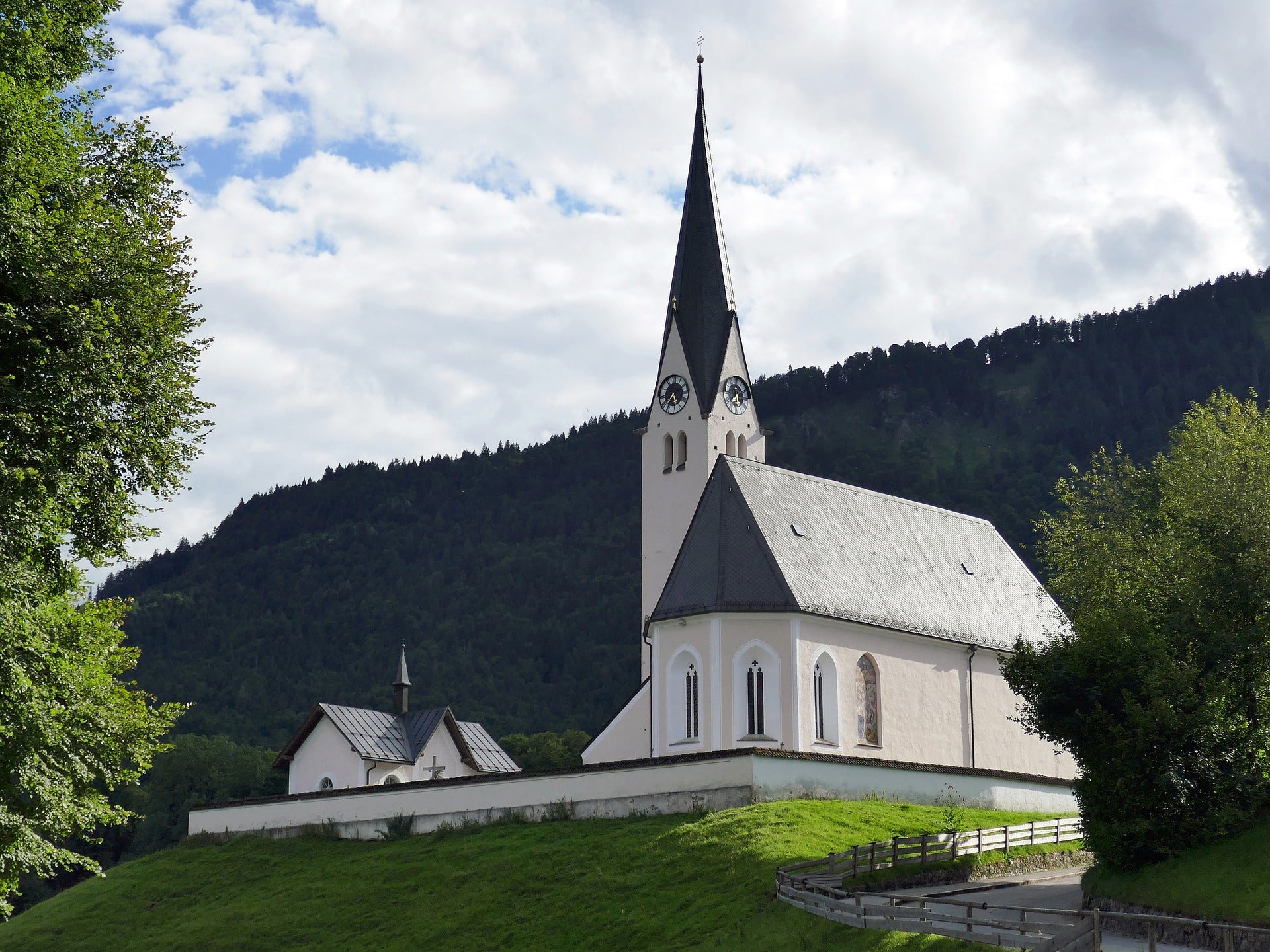
The Tegernsee
The location of Tegernsee is on the Bavarian Alps and is an ideal tourism location. It is the cleanest lake in Bavaria. This area is a protected landscape area for Lake Tegernsee and its surroundings. The administration of the entire area, with its state palaces, gardens and lakes, and the branch Chiemsee in Prien belongs to the Free State of Bavaria.

The Tegernsee is an important economic factor for the communities and the hermits for tourism and the health services offered around the lake. The coordination and organization are coordinated by Tegernseer Tal Tourismus.
Tourism here has three legs. Namely mountain tourism with its magnificent hiking routes, recreational tourism and also congress and seminar tourism. Many hotels organize large and small conferences, seminars and workshops for companies from home and abroad. Companies based in the greater Munich area in particular take advantage of these offers. In this article we have made a short summary of the best hiking routes for you.
Hiking routes at Tegernsee
The Tegernsee is visited every weekend by the stress-stricken mountain lovers of Munich. Here you can walk, go boating, cycle and hike or walk straight to the Bräustüberl. If you are planning a weekend event to Tegernsee, you should get up early, otherwise you will end up in heavy traffic on the A8 and struggle at a slow pace from Holzkirchen to Gmund.
The eastern and western sides of Lake Tegernsee invite you to mountain tours, leisurely hikes and beautiful alpine pastures.
The 10 most beautiful hiking routes to recommend:
1. Tegernseeer Höhenweg
The high trail at Tegernsee has to be seen, because nowhere else do you have the options like here.The Tegernsee and the five valley communities lie spread out at your feet. The mountain path leads gently up and down with fantastic views from Gmund to Tegernsee. The hike begins at the parking lot in Gasse and continues in the direction of Ober- and Unterbuchberg. From here you follow the high path that takes us via Sankt Quirin to Tegernsee. We can easily use the bus, train or boat. If you came by bus, follow the signs for the Höhenweg from Gmund train station.

The path is usually halfway up, is wide enough and takes us past small streams. Sometimes briefly through forests again, with many possibilities. The path is also very suitable for trips with dogs.
- Wallberg
The route starts from the valley station and we follow the signs onto the wide forest path and always uphill. The “Wallberg” route is very well signposted.At the Wallbergmoosalm we turn left and always follow the path, which after a while turns into a path.The two paths then meet and we continue uphill along the forest path. The path slowly becomes flat and the forest becomes light and offers panoramic views. At the saddle we already have a beautiful view of the Setzberg and Risserkogel mountains, which can be easily climbed from there.

The hike continues along the signs to the left and now it goes steeper uphill. Here we will soon have a great view of Lake Tegernsee. We have the mountain station in front of us and briefly enjoy the view. We continue on the path, which becomes steeper below the summit. There are many rest areas at the summit where you can enjoy the 360 degree panorama.
3. Leitzachtaler mountain views in Fischbachau
We start at the Fischbachau tourist information office.We walk on less wide paths over the Kalvarienberg to Birkenstein. A visit to the pilgrimage church is a must and from there you continue in the direction of Schwaigeralm.
The "Leitzachtaler Bergblicke" path goes through an alpine area with green meadows and shady forests via Elbach to Kirchstiegl. You can fortify yourself with a good meal at the Gasthof Kirchstiegl.
Then continue into the Leitzachtal. Now we come to a narrow path for romantics. Here you can hear the roar of the Leitzach and look out over the green meadows, hills and forest. Afterwards you can also see the summit of the Wendelstein. Finally the path leads us back to Fischbachau.
4. Halserspitze
The forest path towards Siebenhütten is the starting point. We follow the path uphill to the right in the direction of Halserspitze. When we are at the end of the forest, we pass the Königshütte and follow the Felsweißach into the Wolfsschlucht.
A pleasant hike up to the trail continues with a much steeper and rocky hike. First you come to a short steep section where you have to decide whether it is too difficult for us or not. The trail then continues uphill in short serpentines and over a steep section secured with ropes. In some places we cross small scree fields and larger steps. Always pay attention to the markings here. As soon as we approach the Wolfsschlucht, there are a few secured paths that we can walk slowly but without major problems.

After working hard for a good 2 hours, we arrive at the exit of the Wolfsschlucht, where we finally descend to flat and easy terrain. We ignore the turnoff to Schildenstein and follow our destination. If you don't want to go uphill again at this point, you should go to the Schildenstein.
On the other hand we follow left to the Blaubergalm. A stop with a marmot and a Guffert view is an opportunity. Follow the signs over the rising grassy slope towards the summit. The view on the ridge is great and because the path is quite easy, you can really enjoy it. After approx. The first “summit”, the Wichtelplatte, is reached after 3 hours of hiking. Shortly afterwards we pass the Blaubergschneid, the Blaubergkopf and the Karspitz. A little while before the last climb, we pass a junction and after approx. 4h hiking time on the Halserspitze. The view is unimaginable and sensational.
- Riederstein
The tour in Tegernsee begins at the hiking car park near the shooting range. We go down the old parking lot and from there up the stairs. Then we keep left and left again at the next junction. Then after a few minutes turn right and follow the forest path towards Berggasthaus Galaun.
First we go through the forest, where it is flat and later becomes steeper again after the fork in the road if you go up to the right. A wide curve to the left leads us to the Galaun inn. Here you can eat, drink and relax on the terrace.
Right at the back of the inn is the Stations of the Cross. The main route up to the chapel is via wooden steps. There are plaques along the path that explain Christ's suffering and death. Here you will encounter a magnificent view over Lake Tegernsee, which you can see from the chapel. From Galaun the path goes steeply down towards Rottach and approx.100m. Height back on the Leeberghöhenweg.
- Hirschberg
Directly behind the lift, go uphill on the left towards Hirschberg. The forest path is not very steep and leads to the ski slope. But after that, on the next path it becomes significantly steeper and we hike up. When you arrive at the piste, the path turns back into the forest path and continues uphill. It is well signposted to the Rauheckalm. From there the path becomes an easy path again, which we follow along the buildings and uphill past a stylish wooden lounger.

During the next ascent, the first view of the Schieber (summit next to the Hirschberghaus) and the Tegernsee begins. Then we reach the intersection on the ridge. We go left and come to the junction from the Hirschberg summit. The great view of Lake Tegernsee can be enjoyed and all the peaks of the Bavarian foothills of the Alps can be seen.
Then we continue towards Hirschberghaus. The path is partly steep and you should be careful not to be distracted by the great view.Here you reach the material railway and follow the forest path to the right.
- Setzberg and Risserkogel
We start with a ride up the Wallbergbahn from the valley station. Of course, you also have the option of skipping the Wallbergbahn and hiking up the Wallbergmoos. On the way after the ride on the cable car, we first go down to the saddle and then finally to the Wallberghaus.
Shortly afterwards comes the first climb for us, up to Setzberg. The rest of the route takes us south on a path with ups and downs to Grubereck. Then continue east to Risserkogel. The path in front of us goes down to the Riederecksee and to the alpine meadows below the Blankenstein climbing mountain.
After we reach the Karsee via Blankenstein, the Röthensteiner See, where we can wash our feet, we almost only go downhill, along the Rottachalmen down to the Valepp valley and to Enterrottach. Here comes a hiking trail on a straight level, past the slopes of the Wallberg, where we come back to the valley station of the Wallbergbahn.
- Neureuth von Gmund
Our route begins at the parking lot in the Gasse district and then we move towards Oberbuchberg. The very steep paths wind wildly romantically through the mountain forest up to Neureuth. On the Neureuth you can experience everything you can do on a hiking trail. The 1st261 m high mountain in the east of Tegernsee, has a variety of relatively easy paths and paths.

After we arrive at the Neureuthhaus restaurant, we can take a short break. This very popular hiking destination has an elevation of 1.216m. Here we can have a meal, where we have the beautiful view of the foothills of the Alps and of Tegernsee and Schliersee in front of us. When we are finished, we walk past the restaurant to descend to Tegernsee / Lieberhof. You certainly have tired legs here and that's why we either take a bus or a boat on the way back to Gmund. If you are still fit enough, you can walk back to Gmund via the Höhenweg.
- Bodenschneid
The route begins at the parking lot and we hike along the tar road, initially quite steeply, then moderately uphill to the Untere Firstalm. We are on the left side and continue uphill in front of the terrace to Suttenstein and Bodenschneid. You have a great view up to Suttenstein. Then we follow the Setzberg, Guffert and Risserkogel path on Schinder.
Before the Suttenstein, turn right towards “Bodenschneid”. The path now becomes rooty and significantly steeper, but nice and shady. You also have a great view of Brecherspitz and the two Firstalmen.We continue on the path and it becomes flatter after a while. Now we pass a junction to the Obere Firstalm. Then we see the huge summit cross, which we reach approx. Have reached 2h total time. The upper Firstalm junction is also our way back, downhill.
- Siebenhütten and Königsalm
Our route begins at the Wildbad parking lot in Kreuth. We walk to the Altes Bad restaurant and from there we take hiking trail 615 to the Alm in Siebenhütten. We walk over a bridge behind the Alm, then go in the right direction and walk along the Hofbauernweißach to the junction of the path to Schildenstein and Königsalm.
The path soon climbs into the mountain forest on the western side until we arrive at the Geißalm with the brick hut. The Geißalm is known for its goat whey. It was a sought-after cure in Wildbad. We then hike to the right on the lower path that branches off to the Königsalm. On this path we go quite pleasantly, over the stream and on the southern side, in the grazing season, the Königsalm with its 46 meter long hut.
This place is very typical of the example of Alpine building. You should definitely enjoy a meal break here with the delicious alpine products. From the Königsalm we walk downhill in open terrain and through the forest. Below we meet hiking trail 501, on which we pass the Weißach and return downstream to Wildbad Kreuth.
Did our article help you? Or do you have any questions or suggestions about our topic? Please feel free to leave your comment below. We welcome your questions, criticisms and comments and we will be happy to answer them.


