


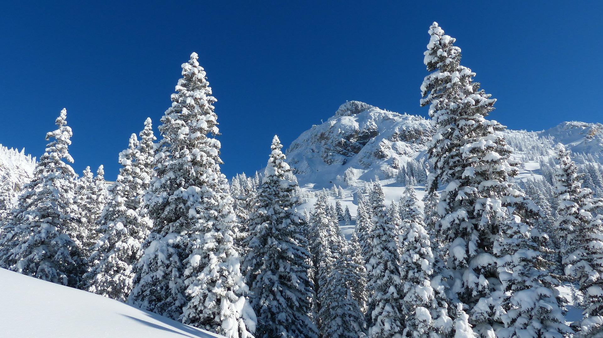
Mountains in Tyrol

Mountains in Tyrol
The impressive mountain world with its three-thousand-year-old, majestic rings is one of the highlights of your holiday in Tyrol.
Mountain ranges such as the Karwendel Mountains and the Kitzbühel Alps in North Tyrol and the Hohe Tauern in the east of Tyrol invite you to unique alpine experiences. The impressive three-thousanders and snow and ice-covered peaks not only offer a breathtaking backdrop, but also a breathtaking view of the valley.

1.Allgäu Alps
The Allgäu Alps are part of the Northern Limestone Alps and extend from Germany to Tyrol and Vorarlberg.
The Allgäu Alps are a mountain group in the northern Limestone Alps, located east of Lake Constance. However, the Allgäu Alps are not closely related to the region of the same name in Germany, which only covers a small part of the Allgäu Alps. The Allgäu Alps extend over an area of approximately 75 by 50 kilometers from Bavaria and Baden-Württemberg to the Austrian states of Tyrol and Vorarlberg. The flora of the Allgäu is one of the most diverse in the Alps.
In Tyrol there are two subgroups of the Allgäu Alps: the Tannheim Mountains and the Vilsalpseeberge. The Tannheim Mountains are separated from the rest of the Allgäu Alps by a homogeneous valley. In the past, these mountains formed an independent mountain group. The Vilsalpsee mountains lie on the edge of the Tannheimer Valley and, together with the Vilsalpsee, are a popular hiking destination.

The peaks: The most important mountains in the Tannheim Mountains are the Kellenspitze (2.238 m), the Rote Flüh (2.108 m), the bullfinch (2.173 m) and the Gehrenspitze (2.163 m). The main peak of the Vilsalpseeberge is the Leilachspitze (2.274 m). Six of the ten highest peaks in the Allgäu Alps are in Tyrol.
Hiking trails: The area around the Rote Flüh, the Gimpel, the Kellenspitze and the Gehrenspitze is particularly popular with climbers. There are also several lakes in the Allgäu Alps, some of which are protected and are popular hiking destinations. In the high mountains there are 24 huts of the local Alpine association AVS and several long-distance hiking trails that pass these huts, such as the European long-distance hiking trail E4 (Pyrenees-Crete), the European long-distance hiking trail E5 (Atlantic-Adriatic) and the Via Alpina.
2.Brandenburg Alps
The Brandenburg Alps, also known as the Rofan Mountains, are a subgroup of the northern Limestone Alps of the Eastern Alps.

The Brandenburg Alps are located in the state of Tyrol and are bordered by Lake Achensee, the Inn Valley and the Bavarian Prealps. The Brandenburg Alps are often referred to as the Rofan Mountains, although this term only describes the mountains between the Brandenberger Ache and the Achensee. The Brandenburg Alps cover the area from Kotalmjoch to Rofanspitze.
The Brandenburg Alps are bordered by the Bavarian Alpine foothills in the north, the Kaiser Mountains in the east, the Kitzbühel Alps in the south, the Tux Alps in the southwest and the Karwendel Mountains in the west.
The peaks: The most famous mountains include the Hochriss (2.299 m), the Guffert (2nd195 m), the Rotspitz (2.067 m), the Seekarlspitze (2.261 m), the Rofanspitze (2.259 m), the Pendling (1.563 m), the chocolate bar (2.165 m) and the Vordere Sonnwendjoch (2.224 m)
Hiking trails: These mountains also offer many opportunities for hiking and walking. One of these is the “Rofanrunde” with an overnight stay at the Erfurter or Dalfazalm.

3.Gailtal Alps
The Gailtal Alps are an alpine limestone chain that also includes mountain ranges such as the Lienz Dolomites.
In the south of Austria, more precisely in East Tyrol and Carinthia, the Gailtal Alps stretch over 100 km. This limestone Alpine chain stretches between the Drau and Gail valleys and includes the Lienz Dolomites. Although the Lienz Dolomites are named after the neighboring Dolomites, they are not part of the Dolomites and are not made of dolomitic rock. From a geological point of view, the Gailtal Alps do not belong to the Southern Alps, but to the Eastern Alps. The neighboring mountain ranges are the Villgraten Mountains in the northwest and the main body of the Carniolan and Karawakian Mountains in the south. In the east the Gailtal Alps border the Gurktalps, while in the north the Ankogel, Kreuzeck and Schober mountain ranges rise.

The Weissensee in Carinthia, the highest bathing lake in Austria, is also part of the Gailtal Alps. The Lienz Dolomites extend over a length of around 40 km from the Kärntner Sattel, east of Sillian in Hochpustertal, to the Gailbergsattel. The Gailtal Alps also include the Reisskofel group, the Latschur group, the Spitzegel group and the Dobratsch and extend as far as Carinthia.
The peaks: The highest mountains in the Gailtal Alps are the Große Sandspitze (2.770 m) and the Reisskofel (2.371 m). Other notable peaks are the Spitzkofel (2.718 m), the Jauken (2.275 m), the Gamswiesenspitze (2.486 m), the Lumkofel (2.287 m), the saddle nock (2.033 m) and the Spitzkopfel (2.223 m)
Hiking trails: The “Gailtaler Höhenweg” is a 150 km long hiking trail. Available huts in the Gailtal Alps are the Karlsbader Hütte, the Kerschbaumeralm Schutzhaus in the central Lienz Dolomites and the Comptonhütte in the northern part of the Reisskofelberg.
4.Grossglockner
The highest mountain in the Hohe Tauern is the Großglockner (3.798 m).

The Hohe Tauern massif stretches across Salzburg, Carinthia and East Tyrol and is a central high mountain range in the Eastern Alps. The Hohe Tauern is divided into two parts: the Villgraten Mountains and the mountain ranges Granatspitz, Glockner, Goldberg, Kreuzeck, Schober and Ankogel. In addition, the Hohe Tauern mainly consists of crystalline and slaty rocks, which are quite complex in their composition. This 120 km long mountain ridge forms the center of the Eastern Alps. In the Hohe Tauern the ice begins between 2.700 and 2.Appear 900 meters.
The Salzach flows in the north of the Hohe Tauern, the Drautal in the south, while the western border is formed by the Krimmler Ache and the Ahrntal in Italy. To the east are the Großarltal, the Murwinkel and the Katschbergpass. The most important junctions are the Felbertauern Tunnel, the Großglockner Alpine Panorama Road and the Tauern and Katschberg Tunnels.
The peaks: The impressive mountains of the Hohe Tauern include the Großvenediger (3.666 m), the Great Muntanitz (3.236 m), the Hocharn (3.254 m) and the Hochalmspitze (3.360 m). And of course the "King of the Eastern Alps", the Großglockner (3.798 m).
Hiking trails: With 1.At 836 square kilometers, the Hohe Tauern National Park is the largest national park in the Alps. Numerous educational trails provide interesting information and you might even spot a marmot or a chamois.

5.Kaiserberge
The Wilder Kaiser and Zahmer Kaiser mountain ranges dominate the Alps on the German-Austrian border.

East of the Inn, near Kufstein, there are two almost parallel mountain ranges, the Wilde Kaiser and the Zahmer Kaiser. The southern mountain range, the Wilder Kaiser, lies entirely in Tyrol. In the south it borders on the Kitzbühel Alps, in the east the mountains are lower and in the north the Zahmer Kaiser borders on the Wilder Kaiser. The natural transition between the two mountain ranges is the Stripsenjoch (1.577 m). The Wilder Kaiser mountains are surrounded by good valley connections. Ideal starting points for mountain hikes are Kufstein, Scheffau, Ellmau, Going, St. Johann in Tirol and Griesenau.
The Zahmer Kaiser forms the northern part of the Kaiser Mountains. In the north are the Chiemgau Alps. The Zahmer Kaiser is also called Sonnkaiser, Ebbser Kaiser, Walchsee Kaiser or Hinterkaiser by the local population. With the exception of the front boiler cutting (2.002 m) the mountains of the Zahmer Kaiser do not exceed 2.000 meters. There is a third “emperor” in the region: the Lower Emperor. This mountain range connects to the Wilder Kaiser in the southeast. The small ridge is no higher than the tree line.
The peaks: To name just a few of the most beautiful mountains in the Wilder Kaiser: Ellmauer Halt (2.344 m), Sonneck (2.200 m), Goinger Halt (2.242 m), Scheffauer (2.111 m), Mitterkaiser (2nd011 m), Zettenkaiser (1.968 m) and Karlspitzen (2.281 m). The most important mountains in the Zahmer Kaiser are Pyramidenspitze (1.998 m), Vordere Kesselschneid (2.002 m), Elferkogel (1.601 m), Petersköpfl (1.745 m) and Naunspitze (1.633 m).

Hiking trails: The mountains of the Wilder Kaiser offer fantastic panoramic views, but also great hikes. For example, you can climb to the top of the pyramid with a fixed cable car. But there are also very easy paths that can be walked by anyone. The Niederkaiser ridge also has many surprises in store, such as via ferratas and the most beautiful waterfalls on the Kaiserberg.
6.The Karwendel Mountains
The Karwendel Mountains offer many opportunities for nature lovers.
The Karwendel Mountains, also called Karwendel, are part of the Northern Limestone Alps and are located mainly in Tyrol, but also in Bavaria, Germany. The Karwendel Mountains are related to the Bavarian Alps: The name "Karwendel" refers to the entire mountain range between the Isar and Inn and Lake Achensee. The Karwendel Mountains consist mainly of limestone and dolomite, which occur in the Erlspitz Mountains.
The main ridges slope towards the south and, with their steep slopes, form vertical rock faces of over 1.000 meters. On the south side there are further slopes that were formed by glaciers during the Ice Age. Hermann von Barth, the mountaineer who opened up most of the mountains, introduced the idea of naming mountain ranges after valleys. The Karwendel Mountains border on the Bavarian Prealps, the Brandenburg Alps, the Tux Alps, the Wetterstein Mountains and the Mieminger Range. Herds of chamois can often be found in the high altitudes of the Karwendel Mountains, and ibex can also be found in the Sonnjoch region.
The peaks: The most important mountains in the Karwendel are the Birkkarspitze (2.749 m), the Hafelekarspitze (2.334 m), Mrs. Hitt (2nd269 m), the Erlspitze (2.404 m), Sonnjoch (2.457 m), Gamsjoch (2.452 m), Vordere Brandjochspitze (2.559 m), Großer Solstein (2.541 m), Torkopf (1.929 m) and Großer Bettelwurf (2.725 m).

Hiking trails: The Karwendel Mountains are a protected area. With an area of 727 square kilometers, the Karwendel Alpine Park is one of the largest nature parks in the Eastern Alps. Popular starting points for hikes are Scharnitz, Mittenwald, Seefeld, Hallö Pertisau or Eng. The most popular fixed routes in the Karwendel are of course the Innsbruck and Mieming routes. The hike from Scharnitz to Lake Achensee with its impressive mountain landscape is also a classic.
7.Kitzbühel Alps
The Kitzbühel Alps extend across the Austrian states of Tyrol and Salzburg.
The Kitzbühel Alps extend into the Zillertal and Lake Zell. In the south, the Kitzbühel Alps are bordered by the Gerlos Pass and the Salzach Valley, which separate the mountain range from the Venice Mountains. The Kitzbühel Alps are bounded in the north by the Kaiserberge, in the northeast by the Loferer Steinberge and Leoganger Steinberge, in the east by the Salzburger Schieferalpe, in the south by the Großglockner, in the southwest by the Zillertal, in the west by the Tuxal and in the northwest by the Brandenburger Alps limited.
The Kitzbühel Alps include the regions of St. Johann in Tirol, Kitzbühel, Pillerseetal, Brixental, Wildschönau and Alpbach.
Peaks: The most important peaks in the Kitzbühel Alps are Western Salzachgeier (2.469 m), Kröndlhorn (2.444 m), Großer Rettenstein (2.366 m), Geissstein (2.469 m), Kröndlhorn (2.444 m), Großer Rettenstein (2. 366 m), Geissstein (2.366 m) and Kitzbühel Alps, 363 m), Wildseeloderer (2.118 m), large hatchet (2.309 m), Großer Galtenberg (2.425 m), Hohe Salve (1.828 m), Schmittenhöhe (1.965 m) and Hahnenkamm (1.712 m).
Hiking trails: The Kitzbühel Alps, characterized by steep peaks, are ideal for hiking and skiing, as the region has several large ski areas. The region is also characterized by numerous alpine pastures and inns. Enjoy exploring the landscape.
8.Lechtal Alps
Lechtal Alps are characterized by the striking main ridge.
The Lechtal Alps extend across the federal states of Tyrol and Vorarlberg and are the largest mountain range in the Limestone Alps north of the Eastern Alps. The main feature of the Lechtal Alps is the varied composition and appearance of the rocks. The Lechtal Alps include the only 3.000ers of the northern Limestone Alps, the Parseierspitze (3.040 m).

The Lechtal Alps are bordered in the north by the Allgäu Alps, in the northeast by the Ammergau Alps, in the east by the Mieming and Wetterstein Mountains, in the south by the Ötztal and Samnaun Mountains, in the southwest by the Verwall and in the west by the Lechquelle Mountains.
The peaks: The highest peaks are the Parseierspitze (3.040 m), the Darwin Head (2.970 m), the southern Black Head (2.949 m), the Gatschkopf (2.947 m), the Bocksgartenspitze (2.939 m), the Holzgauer Wetterspitze (2.898 m), the Oberer Bocksgartenkopf (2.888 m), the Vorderseespitze (2.888 m), the Freispitze (2.887 m) and the Eisenspitze (2.859 m).
Hiking trails: The Lechtal Alps are a popular hiking area. The European hiking trail E5 crosses the Lechtal Alps from north to south and another popular path leads lengthwise through the Alps. But there are also other paths, such as the Augsburger Höhenweg and the Spiehlerweg. The red and yellow paths of the Via Alpina also cross the Lechtal Alps. There are also via ferratas such as the Arlberg and Imster Weg. The choice is almost unlimited.
9.Leogang Mountains
The Leogang Mountains are a typical karst mountain range and are therefore characterized by a series of caves.
The Leogang Mountains are part of the Northern Limestone Alps and extend across Tyrol and Salzburg. The Roman saddle (1.202 m above sea leveldM) separates the neighboring Loferer Mountains from this mountain range. The Leogang and Lofer Mountains are also managed as related subgroups. The Leogang Mountains are bordered in the northwest by the Lofer Mountains, in the west by the Kaiser Mountains, in the south by the Kitzbühel Alps and in the southeast by the Salzburg Slate Alps, in the east by the Berchtesgaden Alps.
The Leogang Mountains are characterized by a series of caves. The largest cave in the mountains is the Lamprechtsofen (oven = cave), which has been known for centuries. About 700 m of the 51 km long cave is designated as a pilot cave. In North Tyrol, the Leongang Mountains are located in the Pillersee Valley, between the Lofer and Leogang Mountains and the Kitzbühel Alps.
The peaks: Most of the important peaks of the Leoganger Mountains are in the state of Salzburg, including the Birnhorn (2.634 m), the Hochzint (2.243 m) and the Kuchelhorn (2.500 m).

Hiking trails: The neighboring mountains, such as the Kitzbühel Alps, play a more important role for alpine sports than the Leogang mountains. There are two Alpine Club AVS huts in the Leogang Mountains, including the Passauer Hut at 2051m. A fantastic hike begins from Hochfilzen in the Pillersee valley to the Griessen Alps and to the Griessener Hochmossen, a protected area and bird reserve.
10. Loferberge
The Loferberg is located in Austria, more precisely in North Tyrol and Salzburg.
The Loferberg is the mountain range in the northern Limestone Alps and is closely related to the Leogang: the two mountain ranges are neighbors and are sometimes referred to as a subgroup. The two mountain ranges, also known as the Stone Mountains, are separated by World War I.Separated by the 202 meter high Römersattel pass. The Loferberg is a karst mountain range and offers an extensive network of caves. The most famous of these is the Prax ice cave in Salzburg.

The Loferberg borders the Chiemgau Alps in the north, the Berchtesgaden Alps in the east and the Leongang Mountains in the southeast, while the Kitzbühel Alps lie in the southwest and the Kaiser Mountains in the west. In Tyrol there are holiday resorts such as Waidring and Hochfilzen in the Pillersee valley. The Loferer Alm, a popular ski area, is also located in Tyrolean territory, although it belongs to the Steinplatte and not to the Loferberg.
Summit: The highest peak of the Loferberge is the Große Ochsenhorn at 2.511 m. Other important peaks are the Große Reifehorn (2.480m), the Breithorn (2.413m), the Rothörnl (2.394m) and the Seehorn (2.155m).
Hiking trails: On the Loferberg there are two fixed cable cars and the Schmidt-Zabierow-Hütte, the only hut of the local Alpine club AVS on the Loferberg. Otherwise, the mountains in this range are not very well known because they are not accessible by cable cars. The ascent of the Loferer Skihörndl (2.286 m) is, however, a very popular ski tour.


