


Hiking around Vienna

The city of Vienna
Vienna, the federal capital of Austria and one of the nine federal states. Vienna is a federal state with almost 1.9 million. population and approx. 1/5 of the Austrian population. Vienna has an architectural style from the Wilhelminian era and from Baroque and Art Nouveau. It became the cultural center of Europe from 1804 and plays an important role as the imperial capital and residential city of the Austrian Empire. In 1910, Vienna was still the capital of the Habsburg Monarchy and had a population of over two million as the historical center. Schönbrunn Palace is a UNESCO World Heritage Site. Vienna is one of the most visited cities in Europe, with approx. 7.5 million annual tourists and approx.16.5 million overnight guests.

Landscape of Vienna
Vienna is one of the cities located on the eastern edge of the Alps. It is also located at the junction of the foothills of the Alps in the east. The Danube flows through the city center of Vienna.The western part of the city extends into the Vienna Woods and the eastern part is located on the mountain group of the Northern Alps. Most of the urban area is grassland and these are also used for agriculture. Only a small part of the city center is built.
The city of Vienna is located on an area at an altitude of 151m. near Lobau to the Hermannskogel with a height of 542m. extends. On the northwest, west and southwest sides of Vienna is the Vienna Woods with the mountains (Kahlenberg and Leopoldsberg), extending far into the city area.
The Danube flows into Vienna on a narrow plain between Leopoldsberg and Bisamberg. There are also several rivers that flow from the Vienna Woods into Vienna. The entire area from the Ice Age terraces of the Wienerberg to Laaer Berg is used for viticulture. The flat Marchfeld in the eastern part is used as agricultural land but is increasingly being developed. On the southeastern side is the Lobau at the Donauauen National Park. Because of the strong westerly winds that also prevail in many European cities, the western edge of the city is more inhabited because the air is cleaner here. On the other hand, the industrial areas are located more on the southeastern side of the city.
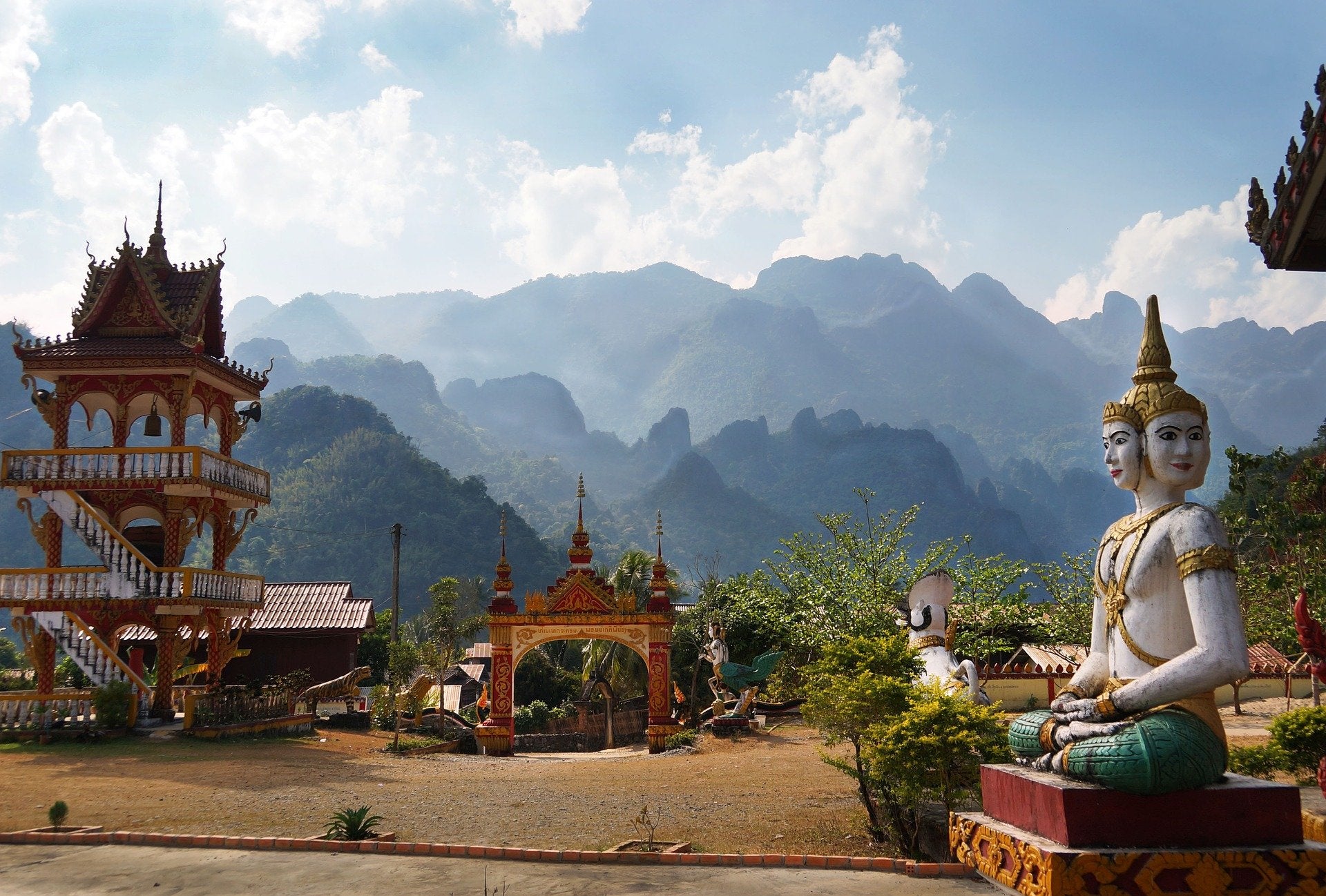
Hiking around Vienna
The magnificent views that can be counted on the Vienna Alps, the paradise of local recreation areas, attract more and more people to Vienna every year. Many hills that provide a change of scenery in the Alpine landscape, the Alpine 2000s of Schneeberg, the Semmering and the Rax, as well as the Hohe Wand as a viewing point leave no one's hiking desires unfulfilled!

The Raxalm has the typical huts that can actually be categorized as pleasure hiking trails. A very old cable car takes us up the mountain and you can therefore hike at serious heights without having to walk on steep paths.
The 10 best hiking trails in or around Vienna:
1- Across the Lindkogel (circular hike)
The route begins at Pottenstein train station and we walk uphill along the Triesting along the cycle path. At the bridge we cross the Triesting and the federal road to reach the blue marking in Einsiedlergraben. We walk over a wooden bridge on a narrow path and cross the forest road that comes in front of us. Then we come to the asphalted Wolfsgeiststrasse following the yellow markings on the left. After we walk past the former Wolfsgeist inn, we turn left at the intersection and walk through the meadows, which offer a wonderful view.

On the hiking trail we reach the forest and arrive at the “Red Cross”, which we reach after 50m. leave behind us on the right and follow the yellow route. We walk along the forest path to the forest road and arrive at the B111. Then we turn right, walk on the B111 to the Rohrbach junction, from which we now walk in a northerly direction, turning right at the last house onto the Alland 9 path in the direction of the high Lindkogel. After we arrive at the summit, we now go downhill to the Merkenstein ruins. Following the red marked path, we cross the B222 and continue straight ahead after the educational forestry buildings to the Herrgottskreuz. Now we turn right on Blumentalweg to the bus stop and return to the train station via Gutensteinerstraße.
2- Hagenbachklamm (circular hiking trail)
The hiking trail begins at St. Andrä Wördern. On Bahngasse we reach the main street on the left and walk on Lehnergasse to the roundabout. Here we go onto Wiener Straße and at the end of the town we come to the chapel hiking trail, which we continue on to the entrance to the Hagenbachklamm. Now we continue hiking on the red-marked path in the direction of Kirchbach/Unterkirchbach and reach the bird of prey station and immediately afterwards to the road intersection.

We stop at the bridge and turn left and then take the first street on the right. On the path to the left of the paddocks we go in the direction of the edge of the forest and follow it along. We follow the bridle path and keep left uphill. After we arrive at the meadow, we take the path that runs across the meadow. So we reach the forest again and keep left when we reach the fork in the road. We follow the paved road that we now reach to the right. Following the signposts, we go to Oberkirchbach and then to St.Andrä before we see the Hagenthal. We continue until we reach the bird of prey station on the left. On the path, left before the barriers, we follow the signs in the direction of St. Andrä Wördern and always go straight ahead. We go downhill to St. Andrä Wördern and from there we come back to the train station via Lehnergasse and the main street.
3- From Kierling to Redlingerhütte (in the Vienna Woods)
The route begins in the center of Hintersdorf. We go straight ahead through the town of Hintersdorf, and at the church we go straight ahead in the direction of Tulln. After about 100m. At the end of the town we arrive at a marker with the sign Hadersfeld and turn right.
On this path we go through the forest, continue straight uphill at the first fork, turn left at the next fork and then downhill. We continue straight ahead to the yellow marking to the B14, which we come to between garden fences and along a small stream near a bus stop.
Here we now take the opposite entrance to the Lourdes Grotto and continue right towards Hadersfeld. At the bridge we stay left on the main path, then go straight ahead to the fork, where we branch off onto a road on the right and then immediately turn right along a yellow marking into a ravine.
We walk steeply uphill on this ravine until it becomes flatter and we reach another forest road, onto which we turn right. Then we follow the path, which goes slightly downhill and comes to a bend to the left. A path now leads us straight into the forest, on which we go downhill to the forest road crossing and shortly afterwards we come across a game feeding area and the path ends. From there we go a little to the right further downhill, turn left, cross a ditch and go right towards the valley. On the marked route below we have to climb through the dense beech bushes and turn right on the marked route. Now we reach the junction to the Redlingerhütte.
From Redlingerhütte we go east into the forest to Kierling. Shortly afterwards we come to a large meadow where there are two benches near the wooden cross. Continuing straight ahead in the direction of the power lines, we take a marked path that takes us through the Mai Valley back to Kierling.
4- From Kahlenberg to Sophienhütte
Our route begins in Kahlenbergerdorf. We go up to Leopoldsberg via the Naseweg and have to walk about 250m right at the beginning. overcome height. On the following well-paved path we continue on several steps until the climb is easy. Every now and then there are rest areas and viewing points where we have wonderful views of the Danube and the federal capital. After we reach the top, we encounter plaques and monuments that remind us of the liberation of the Turks in 1683. If you don't want to go up steep hills here, you can take bus number 38A to Leopoldsberg.

After the first rest, we hike in a westerly direction along the forest rope park to the Josefinenhütte. Here we cross the intersection area across the parking lot and walk about 250m. continue on the blue marking. Now our path branches off to the left and the Höhenstraße is reached. We go straight across the road and find ourselves on hiking trail 04 as far as Sophienalpe. Next we arrive at Café Schönstatt, where we turn right and leave Höhenstraße. Here we come to an approx.1.5km. long forest path that leads us to the “Gasthaus zum Agnesbrünnl”. We come to the Habsburgwarte at the top, along the playground or on the steeper path. Up here we come to a lookout point with a magnificent view and a cozy rest area.
After the rest, walk downhill to the “Grüass Di a Gott Wirt”. We then continue on the blue markings to “Häuserl am Roan”, where we can breathe briefly again. Then we go up to the Hameau, continue hiking to the Exelberg, where we cross the Höhenstraße again and hike for another 30 minutes, after which we reach Sophienalpe again.
5- Elsbeerweg Laaben
The route starts at the Laaben municipal office in an easterly direction. Here we cross the Laabenbach and then take the second street to the right. About 300m. We walk along the Laabental cycle path and then turn left uphill along the forest and meadow path to Rotte Pirate. In the middle of the forest we come to hiking trail 04 and hike along it to the end edge of a farm. Now we go downhill again on the asphalted freight road to the state road, where we turn right in the direction of Brand. After we are on fire, we turn onto the church path on the opposite side of the church and follow it. We walk past the tennis court and the chapel of St. Florian and walk back to the starting point on a beautiful shady path along the stream.
6- Vienna Water Pipe Hiking Trail (circular hike)
The route starts on a meadow path in Bad Vöslau. We start hiking parallel to the Doctor-Robert-Schlumberger-Weg and notice that we are already accompanied by the wine in the numerous wine taverns. Here we are in the thermal region and its pleasure mile. A hike of approx.60min. takes us to Baden, where there are no markings to be found in the city. Now we walk past the Helenen cemetery, walk along the Steinbruchgasse below the aqueduct and after the Hildegard Bridge we come to the Baden lido.

Continuing along Schloßgasse we come to Marchetstrasse and continue on to the casino. Here we walk on Kaiser-Franz-Ring until we come to the junction and turn left into Welzergasse. Then we turn right into Trostgasse and follow it to Flamminggasse. We then turn left and go in the right direction to Schiestlstrasse. Already 100m. The high spring pipeline is further ahead and we continue on to our next destination, the town of Gumpoldskirchen. We walk on this sufficiently wide street for approx.5km. continue for a long time. Many fountains and wine places welcome us on this route. We stop here at one of the beautiful rest areas and then leave Gumpoldskirchen in a northerly direction. Now we have to cross the state road, which is busy on weekends. 1km. We follow our direction for a long time and finally reach Mödling at the end.
7- From Laaben to Breitenfurt
This route is quite a long hike. It starts right in front of the community and we walk in an easterly direction. At the first junction we turn right into the dead end, follow the red-white-red markings to long-distance hiking trail 04. Here we are greeted by a meadow path that runs approx.700m. is long and the end of which leads us to the first farm. We continue on a partly asphalted freight road, then on the forest path and then on the gravel road.

The long-distance hiking trail 04 branches off to the left at the Islandpferdehof Forsthof, where we continue on to the golf course. Shortly after the golf course we turn right onto the unmarked path. We come to the state road again, go east on it and after approx.500m. the lamb's belly. Following the motorway below, we reach Klein-Krottenbach. Again on a piece of asphalt in a northerly direction we hike approx.1.2km. continue until we turn right at the ÖBF wood storage area.
From here we have an approximately 2 ½ hour hike ahead of us on the state road, which takes us along forest and meadow paths to the Schusternazl inn. Over the small Winkelberg we arrive at the Gasthof Zur Wöglering and reach a white-blue-white marked 700m. long walk. On this we come to Stangau, immediately turn left again onto the forest road. A slight climb up the Eichberg and Gernberg brings us to the “Seven Oaks”. We then continue left on a forest road to the sports field and turn left onto the forest path. As soon as we end at the “Red Cross”, we go after about 600m. onto the white-green-white marked path, walk through the forest downhill to Breitenfurt and our route ends at the sports field.
8- Around the Exelberg (circular hiking trail)
The Exelberg route begins at bus stop 43A - Marswiese. Heading east we immediately turn right and then right again onto Waldeg. Now we follow the green markings and come to the Schottenhof, where we cross the street and walk in the direction of the Rieglerhütte. We continue hiking until we reach the fork in the road, keep left and go to the Rieglerhütte. Here we turn right, cross a bridge and then come to the hut.

Keeping right on the gravel road we walk along a steep path to the Sophienalpe. As soon as we reach the top, we go right to the blue markings to the “Red Cross”, leave the asphalt road on the right and reach a large meadow where we can enjoy the beautiful view over Vienna. Continuing on the blue marked hiking trail we come to a forest path next to Tullnerstrasse. After this ends we cross the street and walk on the gravel path towards Schwarzenbergpark. We continue on this path until we have to turn right and go towards Schwarzenbergpark. Shortly afterwards we go downhill on the left side until the asphalt path appears in front of us. Now we turn right and walk straight ahead in the direction of Schwarzenbergallee until we get back to Marswiese.
9- Steinwandklamm (circular hiking trail)
The route starts at the entrance to the gorge, where we get information about the natural monument. The path, secured with numerous steps and footbridges, leads us through the gorge with its blue markings. About 20min. Later we reach the point where we have to decide whether we continue to follow the secured path or switch to the Rudolf Decker Steig, which was built in 1927. The second alternative is a little strict and beginners should avoid this way. Assuming that we have chosen the first route, we leave the via ferrata on the left and continue along the marked hiking trail. A few steps later we reach the junction to the left and, if we wish, we can reach the Türkenloch without danger via the small footbridge with blue markings. But we continue up the Almesbrunnberg and go to the junction with the green markings. On the way we pass the Kneipp basin, we are back on a forest road and towards the mountain houses. It is a spring protection area with a rest area and beautiful views.

As soon as we have had enough of the view, we walk approx.1km. on this path and reach the forest and meadow path uphill to Almesbrunnberg. Here we have to make a little effort to find the way to the summit. We continue on the descent with green markings. We soon leave the forest road and turn left onto the forest path, where we encounter several forest road crossings. Following the yellow markings we come approx.600m. later at the Jagasitz inn, where we enjoy the view of the Schneeberg on the terrace. We come to this after 2km. long hike back to the starting point.
10- Mauerbach – Tulbing (circular hiking trail)
The Mauerbach elementary school is our starting point. We go to Bäckergasse, past the markings. Here we leave path no. 3 and go on path no. 14. After crossing the street at the Hirschengarten animal enclosure, we go to hiking trail no.14 After a short while we come across markings again, from which we turn right onto hiking trail no. 3 reach.

At the upper end of the meadow, which we now reach, there are benches. After a short break we turn left onto forest path no.15 and continue to the forest road. Taking path number 16 on the left, we arrive at the crossroads and head towards path number.4 on the left. As soon as we have passed the Mödihütte, we cross the country road again and come to path no.1 on the right side. It leads us to the Tulbinger Kogel and after we get there we keep half right and go uphill to the Leopold Figl-Warte.
After reaching path no. 18 on the right, we cross a stream twice and come to Groissau. Here we change to path no.4 and cross after about 600m. Take the L121 in the direction of Hermitage and then take path no. 21. On this path we arrive at the Mauerbach cemetery and slowly walk to the elementary school starting point.
Did our article help you? Or do you have any questions or suggestions about our topic? Please feel free to leave your comment below. We welcome your questions, criticisms and comments and we will be happy to answer them.


