


Mountain hiking in the Chiemgau Alps

HIKING IN CHIEMGAU
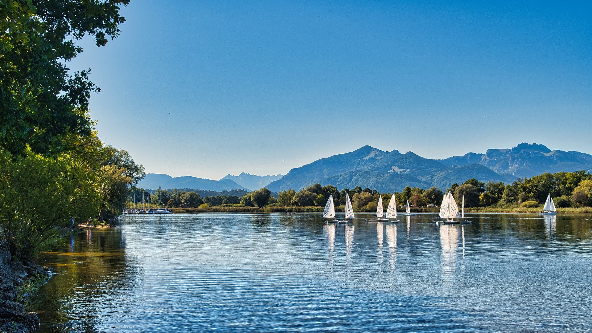
The Chiemgau area is a very beautiful landscape in Upper Bavaria. Rosenheim, Berchtesgadener Land and Traunstein surround this area. The Chiemsee is also called the Bavarian Sea. Located at the foot of the foothills of the Alps and attracts visitors to its hiking routes.
In Chiemgau you can go hiking with your family because they are usually moderately planned. Alpine pastures are mostly visited on the routes, where you can see very beautiful panoramas of the Chiemgau. This environment is also very diverse for sporty mountaineers who want to build fitness or even climb.If you come from the Munich area, you are only 1St. at a distance.

You have many different starting points here where you can start a mountain hike. Some of them are e.g.b: the Samerberg, the Achental, the Priental or Ruhpolding and Inzell. You are welcome to hike quietly in the mountain pastures or plan a long summit tour. In Chiemgau there is something for every nature lover.
The following hiking routes in Chiemgau are very popular:
- Hochfelln
- Pointed stone
- Kampenwand
- Hochstaufen
- Hochgern
- Kranzhorn
- Hochries
- Heuberg
- Fellhorn
- Geigelstein
- High plate
- Zwiesel
- Frasdorfer Hütte
Where exactly are the Chiemgau Alps?
The exact location of the Chiemsee Alpine region is to the north of Wasserburg. Here it goes along the Inn all the way to the Kaiser Mountains to the Austrian border in a southerly direction. The Mangfall Mountains are an area in the west and the Chiemsee lies with its castle of the fairytale King Luwig II. In the east direction. Chiemgau stretches from west to east and from south to north approx. 60km.

When you arrive in the Chiemsee Alpine region, you will find yourself in a landscape that has developed in a very diverse way. Here it is possible that you will encounter the glaciers that were shaped by the Ice Age. Both the Mangfall Mountains and the Chiemgau Alps appear as foothills, of which there are no longer any.If you look south, you can see the mountain range of the Alps with a magnificent aura. Sledding, skiing are activities that you can do in five different regions.
In Bavaria there are a total of 30 bathing lakes where water sports can be practiced. This environment is also very attractive for nature lovers. Chiemsee is the largest lake in Bavaria. In the Alpine region of Chiemgau you will have many surprising experiences in the four beautiful towns of Wasserburg, Rosenheim, Bad Aibling and Kolbermoor.
The traditional Alpine landscape, the charm from the Middle Ages, the flair that has its roots in the Southland have many events, galleries and museums to offer for art lovers. There are also many festivals, festivals, musicals, operas, folk festivals, church holidays and traditional costume festivals for those who enjoy the lively city and its culture.
How long is the circumference of the Chiemsee?
The circular route around Lake Chiemsee is approximately 58km long. Here, pedestrians and cyclists can also take circular routes around the lake close to the shore. You must pay special attention to pedestrians.
Our hiking tours for recommendation
In the Chiemgau Alpine region you have the opportunity to go on hiking trips on almost 400 different routes. Of course, it is impossible for us to explain all of these routes in one article. We have therefore created a list of the 10 best hiking routes for our readers and mountain fans. Below you can browse through these routes and perhaps choose one for yourself.
1. Bauernwand (A mountain tour at an altitude of 1580m.)
The Bauernwand route is a very quiet and uncrowded route. This peak, which is not mentioned by name on maps, is a hidden place that is located above the well-visited Hofbauernalm.
You have to have a bit of a feel for the terrain and, ultimately, a bit of sure-footedness. If you want to climb this small peak, which is popular with locals or locals, you should know that the climb to the summit is pathless and not marked. That's why a good sense of direction is required in this area.
How to get to town: Take the A8 from Munich to Salzburg until you reach the Frasdorf exit. Then drive via Anschau in the direction of Priental near Sachrang. In approx. 4km. Behind Aschau, near the hamlet of Hainbach, you will find a hiking car park on the left side of the road.

2. Zwiesel Runde (A mountain tour at an altitude of 1770m.)
This circular hike near Inzell in Chiemgau, Bavaria, which is a challenge even for experienced mountain walkers, is more suitable for the summer months. Here you are invited to cool forest paths, wonderful views and a ridge walk with many exposed areas. You have the opportunity to rest at the Gasthof Adlgaß, the Zwiesel Alm and the Kohler Alm. From the Adlgaß hiking car park, you go uphill to the Adlgaß forester's lodge and continue along the toboggan run. Continue right along the forest road and after about 100 meters turn left to Zwieselsteig.
How to get to the location: By car from the Siegsdorf exit on the A8, continue on the B306 to Inzell. From the town center follow the turnoff to Adlgaß.
3. Steamboat (A mountain tour at an altitude of 1360m.)
On the Alps in Chiemgau you have numerous tour options of all levels of difficulty. The unknown route leads over the mountain ridge up to the small Racheberg. The steamboat is really a highlight along the ridge. With a little imagination it looks like the bow of a ship, a jagged rocky tooth with an overhang.
How to get to the town: On the B305 you come from the north via Marquartstein and Unterwössen. Here you drive in the direction of Reit until you arrive in Brem. On the outskirts of town, turn east and drive to the signposted Hammerergraben hiking car park.
4. Kohlalm (A mountain tour at an altitude of 1462m.)
The Kohlalm route has a moderate altitude difference of 777m. Located near Inzell in the Alps. The highest point is 1462m. and the panoramas are stunning, making you quickly forget the hardships.
The hike begins at the Einsiedl car park. You march off, leave the St. St. Nicholas Church is on the right and follows the dirt road to the edge of the forest. On trail no. 23 you now go through the forest until you reach the forest road. Continue here in an easterly direction, the forest road climbs slightly, so you reach the path that branches off to the right to the Kohlalm. You reach the ridge via long hairpin bends and just behind it you can see the extensive alpine pastures of the Kohlalm on 1.450 m.
How to get to the location: By car, take the B1 to the A1 - then follow the A1 to the B1 in Salzburg - on the A1 take the exit 297-Wals - finally follow the B1 to the destination in Inzell, Germany .
5. Erlbergkopf (A mountain tour at an altitude of 1134m.)
The hiking route to the Erlbergkopf is more of an unknown jaunt. The mountain walk, which is very quiet and offers very beautiful views, is short and also includes a summit tour on the Kampenwand.
It goes over the meadow slope up to the wooden cross and here you have the delightful panorama for such a small mountain in front of you. The route is ideal for families, and also at the end or at the beginning of the season.
How to get to the location: A8 Munich-Salzburg to the Frasdorf exit. After Aschau and here turn left towards Bernau. After about 3 km, at Ausserkoy, turn right to the Seiseralm. After Hintergschwendt you take a left turnoff and arrive at the hiking car park in Aigen.
6. Hochgern and Jochbergalm (A mountain tour at an altitude of 1744m.)
The Hochgern and Jochbergalm route requires discipline and very good fitness. This summit hike takes you to Hochgern in Chiemgau, Bavaria. The path leads via Agerschwendalm and then back via Jochbergalm. The difficult and strenuous hike is rewarded with magnificent panoramas in the Kaiser Mountains. During the tour you have the opportunity to stop off at the Agergschwendalm, the Enzianhütte, the Moaralam and the Jochbergalmen.
The start takes place in the hiking car park and continues on number. 5 Via Agergschwendalm and the mountain rescue hut we continue to the Enzianhütte and the Hochgernhaus. A mountain path that is not too wide takes you further to the Hochgern summit (1.744 m). Then we hike via No.58 and it goes downhill, the route of which is only suitable for experienced hikers. The way back from the summit cross goes back and at the signpost on a small, steep serpentine path in a southerly direction downhill to the Grundbachalm on the Hochsattel to the Jochbergalmen. In the end we hike to No.52 through the Kaltenbachtal back to the starting point.
How to get to town: Take the A8 from Munich to Salzburg until exit 106 near Bernau. Then on No.109 Grabenstätt and towards the south
7. Feichteck (A mountain tour at 1514m.)
A leisurely family hike with short, scenic and charming views. The route generally leads along beautiful paths and climbs. Across green meadows and through forests over a summit ridge.
How to get to the place: Take the Inntal motorway towards Kufstein to the Nußdorf am Inn exit. Continue to Nußdorf to the junction towards Rosenheim / Neubeuern. Here turn left towards Rosenheim to Breiten. Immediately at Breiten you turn right and drive in the direction of Samerberg. Here you take the path that leads through the Roßholzen up the mountain to Eßbaum. Here you will reach a small chapel and turn right towards Ried. Now drive through a small village near Duftbräu and after about 200m. you come to a junction. Then drive just under 1.5km to the large forest car park.

8. Zinnkopf circular route (A mountain tour at an altitude of 808m.)
The very family-friendly and moderately difficult route takes you comfortably over the asphalt in the center of Siegsdorf up to the Wolfsberg. The delightful panoramas of Lake Chiemsee are admirable. The route begins at the train station in the center of Siegsdorf. Then go up into the hilly Alpine foothills of Chiemgau. It goes along asphalted paths via Molberting up towards Wolfgsberg. The beautiful forest path ends at the Lechner Hütte. Unfortunately, there are no places to stop for refreshments, but if you've brought a snack with you, you can take a break here.
The route continues over the ridge of the Zinnkopf and goes down to Höpfling. Here you can take a short detour up to the site where the Siegsdorf mammoth was found. The path then takes us along the white Traun back to the starting point.
How to get to the location: Take the A8 motorway from Munich to Salzburg. Then take the Siegsdorf exit.
9. Fellhorn (A mountain tour at an altitude of 1765m.)
The mountain called Fellhorn has two distinct sides. On the northern side there are wide alpine pastures and to the south there are steep rocky cliffs. The Straubinger Haus is located below the summit. The route is easy but also long. There are two places to stop for refreshments along the route.

How to get to the location: Take the A8 motorway from Munich to Salzburg. Then take the Siegsdorf exit. Then take the main road to Seegatterl. Here you will see the large forest parking lot.
10. The glider airfield (A mountain tour at 565m.)
The easy hike takes you on paths that don't actually have any significant differences in elevation. Here at Unterwössen it's all about the gliding area. The journey begins at the Balsberg car park, where you walk along the edge of the forest towards the glider airfield. The path then takes us along the Streichenweg past the tennis courts to the junction on the right. Here you continue on Wetterkreuzstrasse to the Windeestrasse junction. Then go left and go to the glider airfield area.
Now you are on the forest path to the Tiroler Achen (path number 16). Here you continue through an original alluvial forest downstream until you reach a sign that points back to the gliding area. Then you continue left and you come back to the way there. A short walk along the edge of the forest and you've already reached the starting point.
How to get to the location: Take the A8 motorway towards Salzburg and exit Bernau. Then in Unterwössen we turn right at the church onto the old village road to the Balsberger parking lot.
Did our article help you? Or do you have any questions or suggestions about our topic? Please feel free to leave your comment below. We welcome your questions, criticisms and comments and we will be happy to answer them.


