


Hiking in Berchtesgadener Land

Berchtesgaden
Berchtesgaden is a town in the Berchtesgaden district in the outer southeast of Upper Bavaria. It is the middle center of the southern part of the Berchtesgadener Land and regionally belongs to Southeast Upper Bavaria. The closest major city in Germany is Munich.

The place between was first mentioned between 1102 and 1105 as a settlement of the Berthercatmen monastery foundation. The first economic profit was made through salt and metal and allowed the place to grow into a market. From 1559 to 1803, the hermits of Berchtesgaden formed a spiritual and secular center for the monastery foundation, where the prince provosts ruled over the small principality of Berchtesgadener Land. It has been the southern region of the Berchtesgadener Land district since 1973.
Berchtesgaden was founded in the middle of the 19th century. Century, based on the sights and natural monuments, became the tourist center that it still is today with a growing number of visitors. The growth gained momentum after the Second World War. After the 1990s, however, the number of guests fell and the community is looking for ecological and environmentally friendly solutions to benefit more from tourism.

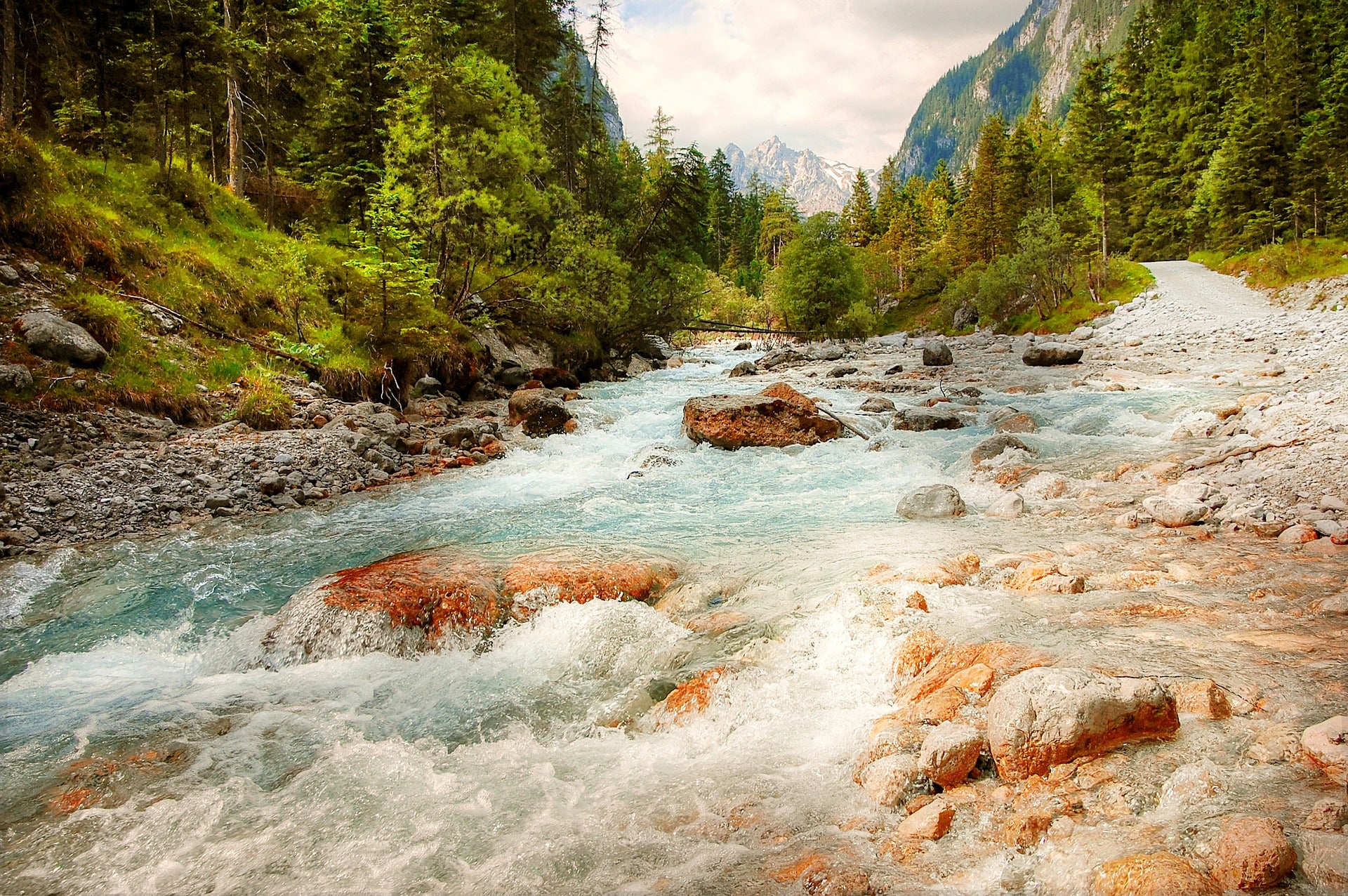
Hiking in Berchtesgadener Land
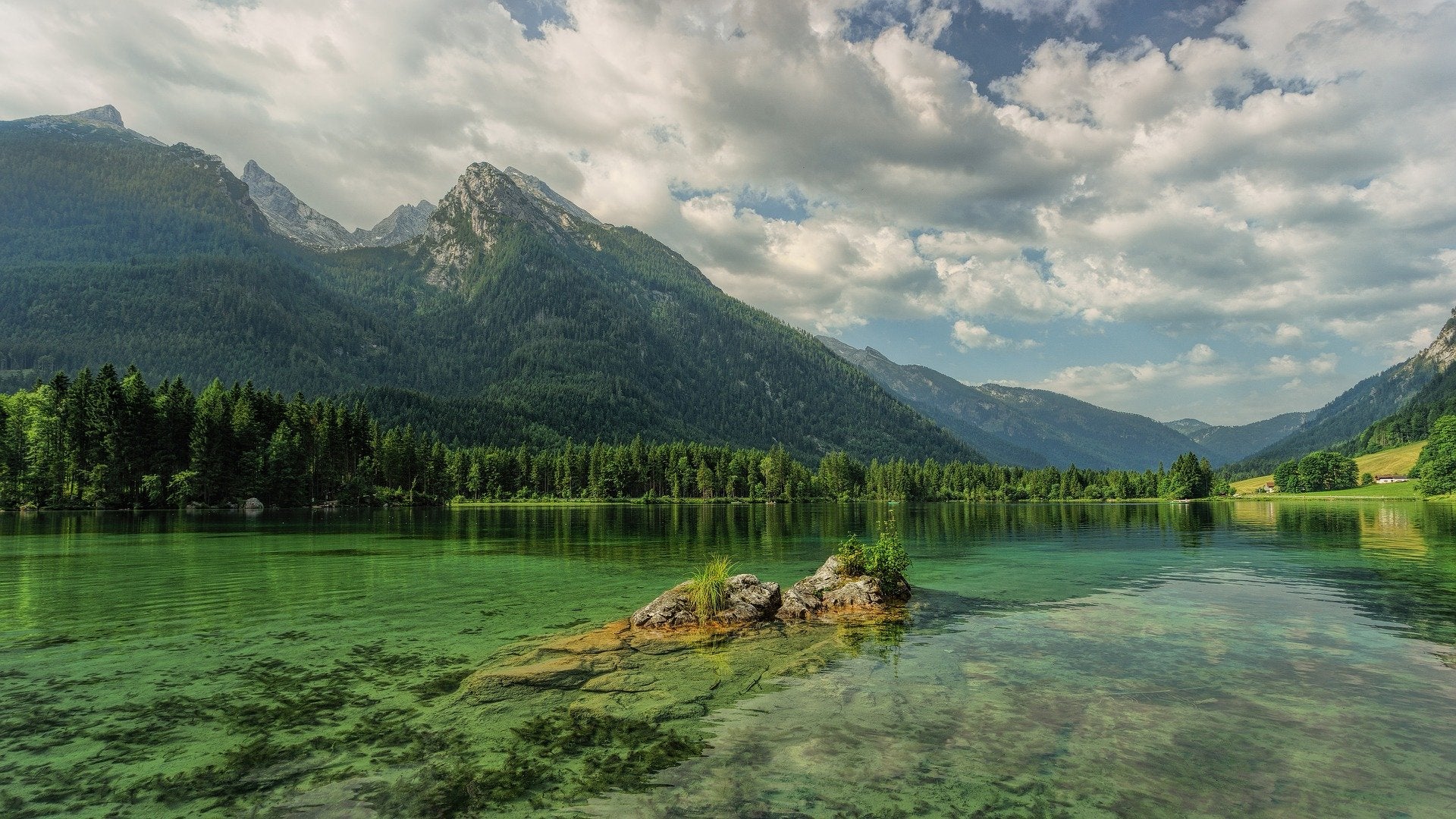
The Alps in Berchtesgadener Land provide wonderful hiking routes and are located partly in Bavaria and partly in Salzburg. Magnificent viewpoints on wonderful mountain tours and hiking trails and exciting summit visits make our hearts beat faster. Managed alpine huts invite us into the landscape to enjoy the beautiful area.
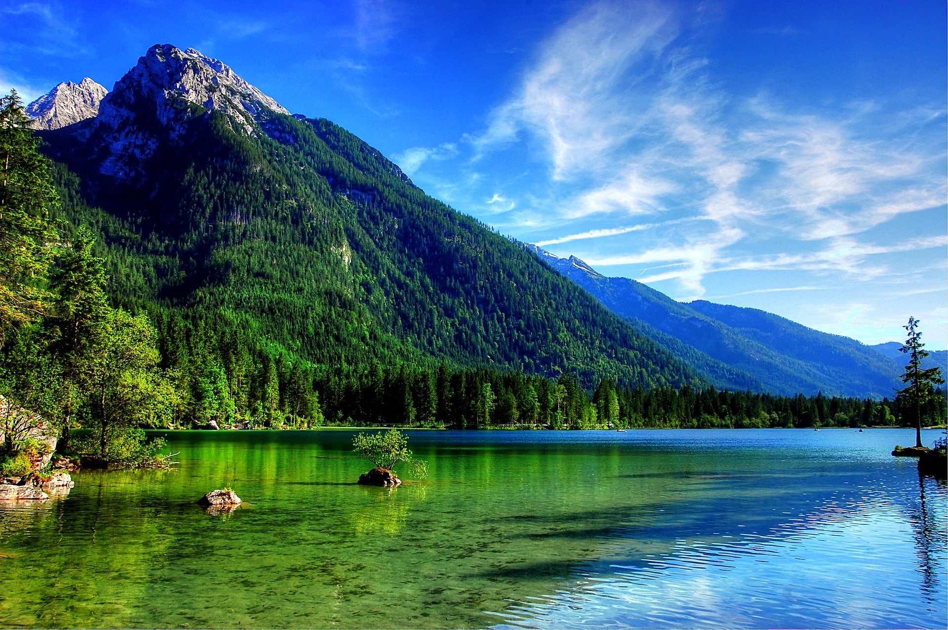
The Watzmann and Hochkalter mountain ranges are part of the Berchtesgaden Alps, which are located in the center. The Hochkönig, the Hagengebirge, the Göll, the Steinerne Meer, the Lattengebirge, the Untersberg and the Reiter Alm are the other heights in the Berchtesgaden Alps. The Hochkönig is 2941m high. the highest elevation. The hiking trails in the Berchtesgaden Alps are particularly well laid out and very well maintained. Therefore, most valley hikes can also be walked with a stroller.
The best 10 hiking routes in Berchtesgadener Land to recommend:
1- Berchtesgadener Höhenweg – 1.Stage
We start at Berchtesgaden train station. Leaving the train station behind us, we go left past the roundabout and along the Hotel Schwabenwirt we follow the Königsseer Ache in the direction of Salzbergwerk to the valley station of the Obersalzbergbahn. We choose luxury and use the cable car, which takes us more than 2 hours. save what we would need for the climb to the mountain station. After we reach the top we take the signs Carl-von-Linde-Weg in the direction of Hochlenzer.
Then we continue on the Carl-von-Linde-Weg until we walk through the small tunnel and then follow the Hinterbrand-Vorderbrand signs. Now we come along the Gasthof Vorderbrand on the left and then go on the right side to the Brandkopf. The wonderful view from here lets us look at the Grünsteinö, the Schönau and the Watzmann. Now we go down the small path on the other side, briefly follow the road and then go up the climb, which leads us to the Jennerbahn middle station. The hiking signs lead us to the Königsbachalm. Our last rest can be taken here before we go back on the forest road to descend via the elevated railway and the Königssee. We walk past the valley station, cross the tourist information office, the parking lot and also reach the bus stop, where our hike ends.
2- Circular hike Obersalzweg
Our route starts at the Kempinski Hotel in Berchtesgaden. We walk straight ahead along a small path towards Obersalzberg. Here we cross the large street and follow the sign to Kehlstein, on the left. Shortly afterwards we turn into the forest and follow it uphill to the intersection at Kehlsteinstrasse. Now we walk on the gravel road after turning left. 2km. We walk long to the next intersection and turn right so that we can walk past the Kehlstein towards the Scharitzkehlalm. After the short climb, on the right hand side is the “Feierabend Bankerl”, where we are invited to take a break.
We continue on Schottstrasse for approx.600m. continue until we follow the sign to the Cream Puff Baron on the right-hand side. We walk briefly uphill onto the car road and then along the narrow path through the forest. After we arrive at the bottom, we stop at the Cream Pouch Baron Inn. We go past the restaurant on the right onto the Carl-von-Linde-Weg towards the way back. We take the walking path with good signs in the direction of Obersalzberg.After the Carl-von-Linde-Weg ends, we turn right and pass the Obersalzweg on the left. We walk past the roundabout and along the pedestrian path until we reach the turnoff to the Kempinski Hotel. Then we go back to the hotel, to the starting point.
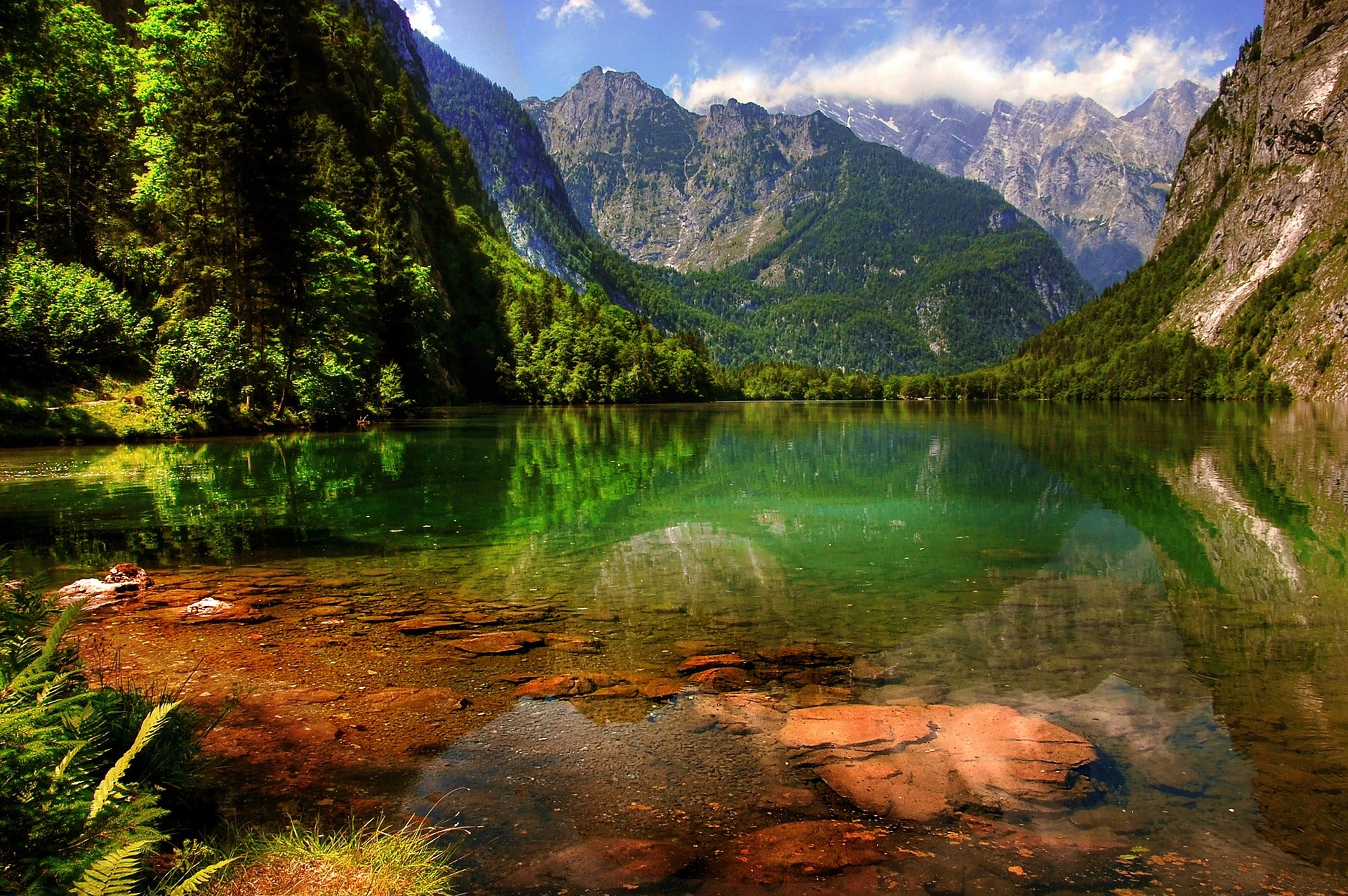
3- From Königssee to Kärlinger Haus (Funtensee)
Our route starts at Königssee and we go to the Kärlinger Haus at 1638m. Height at Funtensee. Up to St. Bartholomä we take the ship across the Königssee. The 1st starts here. Stage correct. First we walk comfortably along the Königssee towards the Schrainbach waterfalls. There is flooding here, usually when the snow melts. That's why we have to pay attention to the signs in order to possibly take a detour. The waterfalls got their name from the Schrainbach of the same name, which is a tributary of the Königssee.

Now we follow the Schreinbach for quite a while and go on the first slope of approx.1329 meters altitude. The path leads us further to the Schrainbach Alm, which is at 900m. located We can take a short break here. We then continue on the path first over a bridge on the Schrainbach and then over the small Mausbachfall. If it rains suddenly here, this fall of the wall can quickly flood the wall path. We climb into the famous Saugasse at almost 1100m. a
The Saugasse is famous for its countless curves. In the suction socket there are approx.47 hairpin bends. The climb is now much easier thanks to these switchbacks, but you should not underestimate the gradient with luggage. Now we come to the last meters of altitude of the day and head towards Funtenseesattel. From there we can also enjoy the first views of the day's destination, Kärlinger Haus am Funtensee.
On the 2nd During the day we cross the mountains in the stony sea, where we have an even more beautiful view. If the weather is good, we can cool off after the short stage at 1300 meters in Funtensee before we go to the hut to eat. Depending on the weather, you should definitely treat yourself to the Viehkogel when you arrive here.
4- Via Zinnkopf and Teisenberg to Stoißer Alm
The route starts on a beautiful footpath down to Eisenärzt, right next to the train station. Here we walk over the tracks and over the stream. We walk 100m. on the main road and turn right onto a steep road closed to vehicles. This route takes us to the Hörgering residential area. We continue hiking in a southeasterly direction and reach the hiking parking lot at the wood storage area. We now continue flatly downhill on the farm road and come to an intersection where the mountain bikers are riding on the left. We, as pedestrians, take a shorter and nicer footpath on the right and walk in an easterly direction to the long bench on the forest road. Right next to it we continue steeply uphill and reach the summit of the Zinnkopf.

The same path we came on takes us downhill for a few minutes and then we keep right twice. Here we come back to a forest road, which we basically follow in an easterly direction. This forest road takes us downhill on many curves to Maisau, where we then go down in the valley across the stream in a southeasterly direction. Heading east we come to a bridge on the left, which we cross and walk up the hill to the main road. After we have crossed the main street, we walk a few meters on the sidewalk and turn right again.
Now stop following the road, but continue along the farm road at the edge of the area to the right of the Markgraben. At 800m. We first turn left and then immediately right again onto the newly created forest road. After the gravel ends, we continue uphill to the next farm road, where we can find signposts again. We continue along this road in a northeasterly direction along the Hubertus Hut until we reach the left-right combination at the stream bed. Now we come to a beautiful path on the left again in a northerly direction. We follow this again to the right on the eastern side until we arrive at the summit of the Teisenberg.
Now we set off again in a south-easterly direction, walk past the chapel and after a few minutes we reach the Stoißer Alm, which is the end of the route. You can then decide the way back yourself.
5- Rinnkendl-Steig & Königssee
The route starts at the Königssee car park and we walk towards the lake to the boat departure. After we crossed the Königssee to St. Crossing Bartholomew by boat, we follow the wide hiking trail behind the church until it leads us into a bay. On path 443 we first go through the steep mixed mountain forest, uphill in wide bends. At the upper edge of the forest we turn the path to the right and overcome the rocky areas via the insured passages. Here we follow the long, exposed crossing and go to the last climb through a gully. Now we reach the plateau and the managed Kührointhütte welcomes us. We then walk downhill through the forest to the Grünsteinhütte and from there to Königssee.

6- Access the elevated railway to the Jenner summit
The route begins at the elevated railway at Königssee. We walk through the shady spruce forests to the Königsbachalm. The elevated railway used to be used to transport wood on sleighs during the winter months. We hike to the Königsbachalm across alpine meadows and through pine stands to the Königsbach gorge to the Schneibsteinhaus.
At Torrener Joch we reach the Carl von Stahl House and have a view of the Austrian Bluntau Valley. Now we continue to the mountain station to the Jennerbahn and up to the viewing platform at the Jenner summit. If you have the 1.000m. If you hate the height difference, you can choose the Hinterbrand car park as your starting point and hike along the Königsweg, past lush meadows, to the Königsbachalm.

7- Mountain tour on the high board
The route to the Hohe Brett starts at the Hinterbrand hiking car park. On the way we follow the direction of the Jennerbahn middle station. At the edge of the Krautkaserfeld we first turn left and follow the steep path uphill. We walk along the Kaser of the Krautkaseralm uphill to the hollow path, which we continue to follow to the Klaus Maxei - Mitterkaseralm.
Here we cross the Mitterkaserkessel and walk along the path over the Jennersattel in the direction of Carl-von-Stahl-Haus. Behind the Stahlhaus comes the Alpine path and we take a short detour to the Pfaffenkegel at 1837m. Height We continue on a steep and rocky path, which is secured by steel cables in difficult places, up to the Jägerkreuz at 2200m. Height Here we take the very leisurely path to the gently rising flank and climb uphill to the summit of the Hoher Brett, which is at 2340m. height is. Either on the same path or the Schneibsteinhaus we climb downhill and go back over the Königsbachalm.
8- Watzmann mountain experience
The start of our route is at Christmas Schützenplatz in Berchtesgaden. First we go towards Königssee and as soon as the world's first artificial ice rink is in our sight, we go uphill on the Grünstein. Now we move on to 1406m. high Kühroint-Alm, where we can fortify ourselves with a snack. We then hike uphill along the Falzsteig in hairpin bends to the Watzmannhaus in the Berchtesgaden National Park, which is at 1903m. located Here we are rewarded with the panoramic view of the jewels of Berchtesgadener Land and the Steinernes Meer. After we finish our lunch break, we go downhill on the same ascent route. You should have completed this descent before the shadows of the trees cover the path and branch off to the Stubenalm. We walk past the Ramsauer Ache on the way back to Berchtesgaden.

9- Loipl pilgrimage church
From the Aschauerweiher car park, the starting point of the route, we go left past the natural swimming pool to the Maximiliansreitweg. Here we turn left in the direction of Bischofswiesen and follow the Maximiliansreitweg. After we reach the Winkl settlement at the forestry service, after the Panorama Park shopping center, we go down and cross the B20 at the railway crossing. Then we go over the wooden bridge to the right into Schneckenmühlweg.

When we arrive at the campsite, we follow the Klaushäuslweg to the left until we reach the turnoff to the Loipl chapel. Then we go back down Thanngasse to Bischofswiesen and turn right into Klemmsteinweg. At Wegscheidlehen we turn right onto the path "Am Wegscheid", cross Loipler Straße and walk along the Quellenweg past the Hotel Hundsreitlehen to Grabenweg. Here we turn left into Keilhofgasse and cross the railway line at the footbridge and the Ache to the village fountain. When we arrive at the Bischofswiesen church, we walk right past the spa hotel through the Datzmannsiedlung to the Maximiliansreitweg. Here we follow the signs and walk back to the Aschauerweiher.
10- Untersberg
After we start our route in Hintergern, we head towards the Kaltwasser service hut. Here turn into Stöhrweg and climb, initially on the edge of the Almbachwand, then on wide serpentines, uphill to the Stöhrhaus. The karst high plateau stretches for kilometers to the north, where the legendary Untersberg south face reaches 400m. falls into the depths in front of us. A little to the east, the Berchtesgadener Hochthronsteig appears vertically through the rock. The route over the Scheibenkaser is our way back. At Theresienklause we can either go downhill through the Almbachklamm to the Kugelmühle or we can take the short counter climb and go back to Hintergern.
Did our article help you? Or do you have any questions or suggestions about our topic? Please feel free to leave your comment below. We welcome your questions, criticisms and comments and we will be happy to answer them.


